The Swisstopo services can be used free of charge for commercial purposes since March 1st. In this blog article I want to show how these high quality data can be published on qgiscloud.com.
Swisstopo-Services
The Swisstopo WMTS services are tiled raster data. Due to the prior tiling, the loading times are significantly reduced. WMTS data are used when an up-to-date background is always required. For publication as a background layer on the QGIS Cloud Platform, the National Maps and the Swissimage orthophoto are very interesting. However, it is also possible to use all other layers that are offered by Swisstopo can also be published.
Integrate Swisstopo services into QGIS
To integrate the Swisstopo services into QGIS the following steps have to be taken. Basically, WMTS layers are added like all other OGC services to the QGIS project.
-
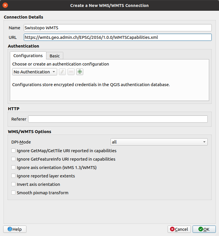
create a QGIS project with the Swiss CRS EPSG:2056
-
add the Swisstopo-WMTS as a new WMS/WMTS connection (url: https://wmts.geo.admin.ch/EPSG/2056/1.0.0/WMTSCapabilities.xml). To do this, do not use the QGIS Browser but the menu Layer -> Add Layer -> Add WMS/WMTS Layer. First you have to create a new WMTS connection there.
-
now connect to the connection you just created.
-
select the layer ‘ch.swisstopo.pixelkarte-farbe-pk25.noscale’ from the list and click on add.
-
in the dialog that appears now you can still select a time state. In our case select
current. -
now you can close all dialogs and you see the map of Switzerland in scale 1 :25'000 (LK25) including the legend sheet in the QGIS map.
After you have done these steps, you can publish the project on QGIS Cloud.
With the future release of the QGIS Cloud Plugin, the important WMTS of Swisstopo will also be loadable as background layer.